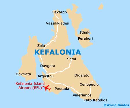
Kefalonia / Cephalonia International Airport (EFL)
Orientation and Maps
(Kefalonia, Greece)
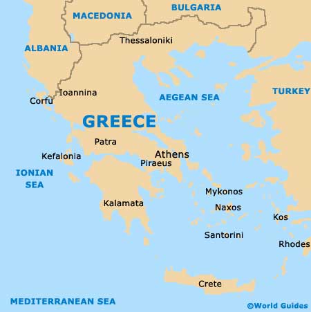
Sited on the western coast of mainland Greece, the island is the biggest and most well-known in the group of the Ionian Islands. With a total population exceeding 42,000 people, Kefalonia features two main towns, Argostoli and Lixouri.
Situated on the southern side of Argostoli is Kefalonia Island International Airport (EFL), close to both Lassi and Minies. During the summer months Kefalonia Airport is especially busy, when passengers arrive from numerous European destinations.
Kefalonia Island International Airport (EFL) Maps: Important City Districts
Much of Kefalonia features dense areas of natural flora and many enticing sandy beaches, a number of which can only be accessed by boat. Amongst the island's most popular beaches, Mirtos is close to the village of Divarata and is famous for its stunning views and the coastline is amongst Greece's finest.
Other popular areas of Kefalonia include the bay of Aghia Kyriaki, to the south of Mirtos and close to the village of Angona. Also popular is Assos, a small and appealing coastal village with a peninsula setting, historic castle walls and local fishing boats aplenty.
Argostoli is a busy town and capital of the island, containing approximately one-third of Kefalonia total population. However, the town of Argostoli is often overlooked and is especially appealing to independent travellers. Lassi was one of the island's earliest resorts to attract large numbers of tourists and has not looked back since, with excellent amenities close to its long stretches of sandy beaches. Lixouri too is an impressive resort destination and features plenty of beachfront accommodation, self-catering apartments and memorable views.
Greece Map
Kefalonia Map